Bannerghatta Road, The Corridor
State Highway 87 is Bannerghatta Road, 45 km in all, leaving Hosur Road at Adugodi, crossing the Outer Ring Road at Jayadeva Hospital and the NICE Road near Gottigere, then running past Bannerghatta and on toward Samanduru. At Bilwaradahalli, on its southern reach, is Nambiar Beverly Green.
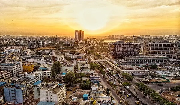
This part of south Bangalore is served mainly by one arterial, Bannerghatta Road, and that is the road Nambiar Beverly Green is on. Formally it is State Highway 87: 45 km of road branching off Hosur Road at Adugodi, taking the Bannerghatta name through Jayanagar, Bilekahalli, Hulimavu and Gottigere, passing Bannerghatta National Park, then continuing as the Jigani–Anekal and Anekal–Hosur roads to end at Samanduru near the Tamil Nadu border. The ending is what makes it unusual among Bangalore's arterials. Old Airport Road runs into Whitefield; Kanakapura Road runs into more Kanakapura Road; Bannerghatta Road runs into forest. That one geographic fact separates the character of the corridor's northern half from the character of the southern reach where this project stands, and it is the thing worth understanding before you judge the address.
What Bannerghatta Road Is
One continuous piece of infrastructure with three roles, that is how to treat the road. Through the city it works as a commuter arterial, six lanes in places and permanently busy, feeding Jayanagar, JP Nagar and the office belt around IIM Bangalore. South of the Outer Ring Road it becomes a suburban artery, lined with the apartment stock, malls and hospitals put up over the last two decades. And past the NICE Road crossing it reverts to a state highway in the plain sense of the phrase: two carriageways running through villages, granite country and plantation land, the national park boundary alongside for much of the way. One road carries all three, and a buyer looking at an address on it needs to know which of the three they are buying into.
Three junctions define it. Adugodi is the one at the top, where the road meets Hosur Road and through it the centre of the city and the Electronic City flyover. At Jayadeva Hospital the Outer Ring Road crosses, and that is where the road's worst congestion has historically been concentrated. Closest to this end of the corridor, and the junction that counts for most here, is the NICE Road crossing near Gottigere: it takes eastbound traffic to Hosur Road, Electronic City and Bommasandra without any run through the city.
The Corridor, Stretch by Stretch
Individual schools, hospitals, malls and tech parks have their distances and travel times on their own pages. Taking the corridor as a whole, here is what each stretch is actually like, north to south.
Adugodi to Jayadeva Hospital
The inner-city stretch: dense, old and fully built, running past Dairy Circle and the edge of Jayanagar. This is a part of the city rather than a suburb, with mature retail, established schools and the Sri Jayadeva Institute of Cardiovascular Sciences at the far end. Traffic on the corridor is thickest here, which is why the metro alignment was routed down it.
Jayadeva Hospital to IIM Bangalore
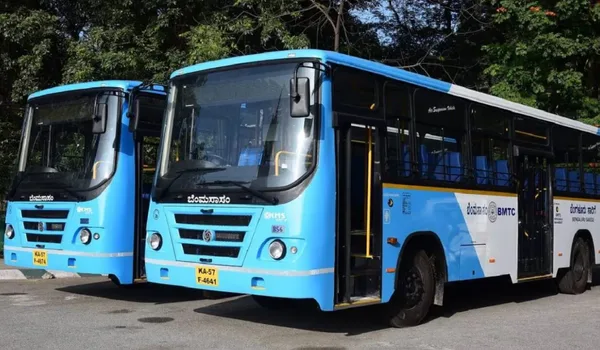
The part of the road most people picture when they hear its name, the institutional and office belt. Near Panduranga Nagar, Fortis Hospital and Apollo Hospital face each other across the road at 10.1 km and 10.9 km from the project respectively, the Indian Institute of Management Bangalore campus opposite them, CHRIST University's Bannerghatta Road campus at Hulimavu. This reach also carries the malls and the corporate office stock: Forum South Bengaluru and Elegance Mantri Mall, also written "Mantri Elegance", both 11.6 km away, with Nexus Vega City Mall at 11.2 km. Land here is the most expensive on the corridor and the traffic the most congested, and the metro's IIMB and Jayadeva Hospital stations are being built into it.
Hulimavu, Kalena Agrahara and Gottigere
The transition. Here the road's character begins to loosen: gated schemes and apartment projects from the 2000s and 2010s, neighbourhood retail, clinics and nursing homes. Kalena Agrahara, the station formerly named Gottigere, is the southern terminus of the metro line under construction. The project's nearest hospital is on this stretch, Medax Hospitals, Gottigere at 5.9 km, and its nearest mall too, Royal Meenakshi Mall at Hulimavu, 7.5 km away. Gottigere is where the NICE Road peripheral crosses, and it is the postal head office for the 560083 pincode. In practice this is where the city ends, and where most residents of the southern reach do their larger errands.
Gottigere to Bannerghatta, the southern reach
The stretch this project is on. Villages strung along the highway, Bilwaradahalli among them, with farmland, granite outcrops and plantation between them, and the wooded country around the national park closing in as you go south. Development arrives one gated scheme at a time from the Gottigere end rather than as continuous suburb. Retail is local, the buses run less often than they do in the city, and the road carries weekend traffic toward the Biological Park that it does not carry midweek. Nambiar Beverly Green is on this reach, at Bilwaradahalli, 3 km from the Bannerghatta Nature Camp.
Southern Reach vs the IIM-B Stretch
The same road has two ends that behave like different addresses. Here is the honest comparison.
| IIM-B stretch (Jayadeva to Hulimavu) | Southern reach (Gottigere to Bannerghatta) | |
| Character | Fully built city suburb | Semi-rural villages and gated schemes |
| Dominant product | Apartments and offices | Villas and plotted-layout land |
| Hospitals and malls | On the doorstep | Reached by driving north on the same road |
| Metro | Stations being built into the stretch | No station; Kalena Agrahara, 6.3 km north, is not open yet, nearest running station is 12.5 km away on the Green Line |
| Traffic | Heavy on weekdays, all day | Lighter midweek; weekend load toward the Biological Park |
| Green cover | Street trees and parks | Forest and plantation on the park side of the road |
| Ceiling on growth | None, it built out completely | The national park; the road ends in protected forest |
In the abstract, neither end is better. If your day is a short commute to an office on Bannerghatta Road, the IIM-B stretch is unarguably more convenient. If you want land, a low-rise home and green that will not be built over, the southern reach is the only part of the corridor still offering it, and the exchange is a longer drive for hospitals, malls and the metro.
The Metro Being Built Down the Corridor
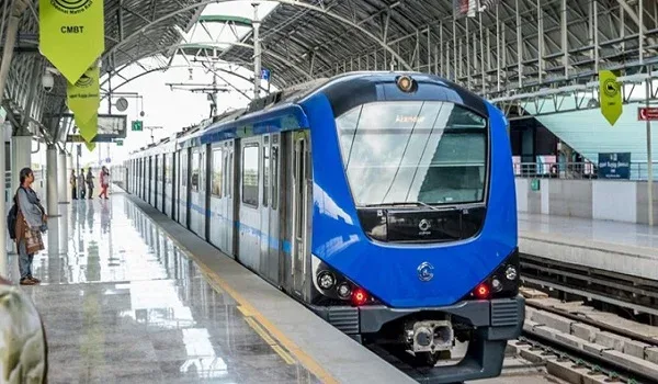
Namma Metro's Pink Line runs from Kalena Agrahara in the south to Nagawara in the north, about 21.25 km and 18 stations, six elevated and twelve underground. Standing on Bannerghatta Road itself are the six elevated ones: Kalena Agrahara, Hulimavu, IIMB, Jayaprakash Nagar 4th Phase, Jayadeva Hospital and Tavarekere. Two things to hold on to. First, the whole of the line is still under construction and no section of the line is carrying passengers yet. The 7.5 km elevated stretch from Kalena Agrahara to Tavarekere was due to open on 15 August 2026; Deccan Herald reported in July 2026 that the deadline would be missed and that it is now expected in late August or early September, with signalling validation still to be completed before the statutory safety inspection. The 13.76 km underground section runs from Tavarekere to Nagawara, with the minister's stated deadline for the full corridor at March 2027, reported in June 2026 by The Hindu and The New Indian Express. The report described the line as delayed again, so read every date here as an expectation and check the current position directly with BMRCL before you let the metro influence a purchase. Second, there is no station on the southern reach: from Bilwaradahalli, Kalena Agrahara is 6.3 km north on the same road and is not yet open, while the nearest station actually running is 12.5 km away, Yelachenahalli or Silk Institute, on the Green Line. The connectivity page has more detail.
Junctions That Decide Your Commute
From an address on the southern reach, three junctions do all the work.
- NICE Road near Gottigere, the eastward escape. It carries you to Hosur Road, Electronic City and Bommasandra without entering the city, and west and north toward Mysore Road and Tumkur Road. For a household commuting to the Electronic City belt, this junction is the whole case for the address.
- Outer Ring Road at Jayadeva Hospital, the way onto the city's southern and eastern arc, and the junction that most affects any drive into central Bangalore.
- Hosur Road at Adugodi, the top of the corridor, where Bannerghatta Road ends and the city proper begins.
Jigani's industrial belt and, past it, Anekal are where the road goes next, further out on SH-87 itself beyond Bannerghatta. A working road rather than a commuter one, and the reason this corridor has an industrial employment base of its own and not only an office one.
Where Nambiar Beverly Green Is on This Road
At Bilwaradahalli, Bannerghatta Road, Bangalore 560083, the project is geo-tagged at 12.823744° N, 77.571837° E, about 3 km from the Bannerghatta Nature Camp run by Jungle Lodges and Resorts. Gottigere is the postal head office for the address. Distances to schools, hospitals, malls, tech parks, the metro stations and the airport are set out on the connectivity page, with dedicated schools and hospitals pages for those. The scheme itself is a 76-acre master development with a 36-acre first phase of 298 plots, on which G+2 villas are built. See the master plan and the villa layouts for what that means on the ground, and the Bilwaradahalli locality guide for the immediate pocket.
What the Corridor Does Not Have
Two gaps deserve stating plainly, because they are the corridor's real weaknesses. There is no railway station on Bannerghatta Road, and none of the Bengaluru Suburban Railway corridors runs down it, mainline departures are from KSR Bengaluru City and Bengaluru Cantonment in the centre of the city. And there is no operating metro on any part of the road today. Every journey from this corridor is a road journey until the Pink Line's elevated section opens: by car, cab or BMTC bus. Anyone modelling a daily commute should model it that way, and treat the metro as upside rather than as a current amenity.
Reading the Corridor as a Buyer
A southern-reach address on Bannerghatta Road brings three things that are hard to assemble elsewhere in Bangalore:
- a full arterial, with a metro line being built down its northern half;
- a peripheral-road crossing at Gottigere that opens the eastern job belt;
- a permanent green edge, because the road ends in protected forest rather than the next suburb.
Convenience is what it costs you: the hospitals, malls and metro stations are all north of you, and none is next door. The nearest metro in service is 12.5 km away, and Kalena Agrahara, 6.3 km north, is not open yet. Electronic City is 15 km and the airport 68 km. The nearest bus stop, Bilavaradahalli Cross, is 190 m from the gate but thinly served: about fourteen departures a day, the first at 5:51 AM and the last at 7:04 PM. For frequent Majestic routes you go to Bilavaradahalli (1.5 km) or Bannerughatta Circle (2.3 km). Timings as shown on Google Maps in July 2026. BMTC schedules change, check the live departure board at mybmtc.karnataka.gov.in before you travel. Measure anything that matters to you in Google Maps from 12.823744, 77.571837 before you rely on it. Related reading: the location overview, schools on the corridor, hospitals on the corridor and Bannerghatta National Park.
*K-RERA registration for this project has not yet been issued; verify project approvals at rera.karnataka.gov.in, and metro timelines with BMRCL.
Frequently Asked Questions
1. What exactly is Bannerghatta Road?
State Highway 87. Over 45 km in all, it branches from Hosur Road at Adugodi, runs south through Jayanagar, Hulimavu and Gottigere, and ends at Samanduru near the Tamil Nadu border. The Outer Ring Road crosses at Jayadeva Hospital, the NICE Road near Gottigere.
2. How is the southern reach different from the IIM-B stretch?
Both are parts of the same road, Bannerghatta Road. The IIM-B stretch to the north is a built-up city suburb of apartments, offices, hospitals, malls and metro. The southern reach, where this project is, stays semi-rural and greener, trading convenience for space.
3. Is there a metro on Bannerghatta Road?
Not in service. The Pink Line is under construction, with six elevated stations standing on Bannerghatta Road itself. None carries passengers yet: Kalena Agrahara is 6.3 km away and closed, and the nearest station running today is 12.5 km off, on the Green Line.
4. Which junction matters most for a commute from this end of the road?
The NICE Road crossing near Gottigere. It takes traffic east to Hosur Road, Electronic City and Bommasandra without a run through the city, and west toward Mysore Road and Tumkur Road. Second is the Outer Ring Road junction at Jayadeva Hospital.
5. Where on the corridor is Nambiar Beverly Green?
On the southern reach, at Bilwaradahalli, Bannerghatta Road, Bangalore 560083, 3 km from the Bannerghatta Nature Camp. The scheme is a 76-acre master development with a 36-acre first phase of 298 plots, on which G+2 villas are built.
6. How far are the main destinations from here?
Schools, hospitals, malls, tech parks, metro stations and bus stops are all listed with distances on the location pages, taken from the project coordinates, 12.823744, 77.571837. Measure anything that matters to you from there.
Explore Nambiar Beverly Green